Saturday, June 30, 2012

Olmstead Loop, Aurburn State Recreation Area, Cool, Ca

June 30, 2012 - Olmstead Loop - Knickerbocker Canyon - Auburn State Recreation Area - Cool, Ca

Oh boy, where do I start with this one? 

First, this trail is known for wildflowers and great views of the canyon, in the spring. My not-so-trusty guidebook suggested this hike for May, however the author's suggested hikes for June had me heading over an hour south I decided to check this trail out in June. The absolute last day of June to be exact. Not my best idea.

Head east from Auburn on 49, follow the highway across the bridge towards cool. (Notice the beautiful and refreshing river here, you'll be missing it later.) Just before the only stop sign in Cool, yes that one, and the fire station, take a right. It's ok, highway is a lofty term for this isolated stretch of road so a u-turn shouldn't be a problem. (It'll be a left turn now.)
It started out nice...

There is a parking lot behind the fire station and a self-pay day use fee. If you choose to park here, the lower lot is for cars, upper lot for horses. I, forgetting my CA state parks pass, opted to park in a nearby parking lot and walk in, via the handy access path. There is water here, hoses and horse troughs, which came in handy at the culmination of the hike.

My guidebook suggested doing the trail in reverse (counter clock-wise) which came in handy for counting down how many miles we had left, and for our shortcut. However I think both ways have their bonuses, for example the end of our hike was rather barren and quite warm, something that may have been better at the start.

The first big view
Moving on. The counter clockwise trail starts on the north side of the parking lot across the road. It parallels 49 and makes it's way around a fenced field, which is a common theme. About a half mile up the road there is a fork and the Olmstead trail turns right with a dirt road extending straight ahead. If you opt for the dirt road version it is supposed to cut off a mile or so from the hike. We opted for the shortcut.

There are many trails that intersect with the loop. The trail is decently marked with yellow triangles reminding the user of trail etiquette.  These are useful if you are worried about getting off track, however since it is a loop, just keep veering to the left when in doubt, or follow the most used trail and you'll be fine. The loop without shortcuts is 8-9 miles with 2 significant up-hill sections and one significant creek crossing. Do be aware that coyotes do frequent the area, as do snakes. Luckily we saw none of the former and the latter one was not poisonous. Phew.

"Tick Creek"
The views are fantastic and the creeks are refreshing, however the large sunny fire road leaves much to be desired, especially in June. As well the wildflowers are long gone.The other downside of this trail, besides popularity and frequent horse related presents, was not discovered until the first creek and then more thoroughly once we returned. Ticks. My guidebook did warn about off-trail consequences such as ticks, so I kept my four-legged friend on leash and out of the brush. Her entire off-leash activities consisted of a 5 minute swim in the creek. I also thought that the heat of the day and time of year would help to diminish the risks. 40+, that's how many ticks we pulled off my little friend, or found in and around the house over the next 3 days. two of which decided to crawl on me in search of their next meal. Yuck, made sleeping very difficult as I was sure there were more in my room and bed, and my skin cooperated by inventing new itches throughout those sleepless nights.
We made it! From here you can see where
we took the first view picture. Waaaay over there... 

In the end the unanimous decision was that this trail is not worth the effort. Heat, ticks, dry, barren, and heavy traffic outweighed the views and the easy access.


Pros: easy to find, ample parking, wide trails
Cons: too hot and dry in the summer, heavy use, TICKS!
Rating: 3/5 for difficulty (due to length and few hills), 1/5 for pleasantness.

Sunday, June 24, 2012

Henry Cowell Redwoods State Park, Santa Cruz County, CA

June 24, 2012 - Henry Cowell Redwoods State Park - Santa Cruz County, CA

This week's hike brought me to the beaches of Santa Cruz, and after struggling with the crowds and parking, I headed for the hills. Literally.

I've discovered that fitting in a hike a week is rather challenging when there are other trips I would like to do as well. My solution? Make it a two-for weekend!

For this particular weekend get away I headed to the Great America Theme park on Saturday and ended up in Santa Cruz on Sunday in time for a nice hike in their beautiful redwood groves. However, on my next trip I would incorporate the Roaring Camp Railroad and the Santa Cruz Beach Boardwalk. The train has two track options, one through the red woods, and the other to the beach and back, saving the visitor the stress of parking and allowing just enough time to catch a few rides, a sweet treat or two and    a dip in the ocean. I started too late in the day to explore these options further, and the price is a little steep so budget accordingly.

And now on to the hike!

To get there find highway 17. Take Mt Hermon exit northwest towards Scotts Valley. The road will dead end at Fenton, (about 3.5 miles)where you can also find a grocery story for some trail snacks. Take a right onto Graham Hill road and take a quick left onto highway 9 south for about half a mile. The entrance to the park is on the right, and the parking lot is about a half mile in. It is a state park so there is a parking fee, or you can park on the shoulder at the entrance and walk in, which is what I opted to do.

From the entrance (not the parking lot) walk in about 100 feet and take a right onto the first trail. This path is a bit dusty but will get you off the road. Follow this trail (there are many off shoots) and it will spit you out  50 feet to the right of the kiosk. I recommend checking in there for park maps and info. I neglected to do this so selecting trails was, well rather interesting. Continue in the same direction and you'll eventually find a Nature Center and the Redwood Grove Loop Trail which is less than a mile in length. This trail is interpretive and well maintained enough for a wheel chair. Grab a pamphlet and start the loop. Loaner pamphlets are available as are fresh copies for a a quarter or so.

To navigate the trail in numerical order, take the trail entrance to the right, but since it is a loop, both entrances work just fine. Once in the grove you'll get to see California Coastal Redwoods, the tallest living things on earth. The tallest tree in this grove is just under 300 feet tall and a proud specimen 1/3 of the walk in. This trail, and the trees are just amazing, from unique growth habits, to the redwood sorrel covering the ground, and of course the majestic redwoods are so very impressive. The down side of this trail however is that it is dog free.

At the back of the loop is the access to a myriad of trails the extend deeper into the park and back toward the entrance and a small river. I chose to continue the Grove Loop, and then return to the small gate, once I had returned my loaner pamphlet.

Before passing through the gate to the additional trails follow the offshoot of the Grove Loop to the Fremont tree. There is a plaque on the trail side that mentions sleeping in the tree. On the backside of this tree you'll be able to see what they mean. From the outside, the tree looks rather normal, large, but other than that, common. Look closer at the burn scar and you'll see it continues deep into the center of the tree. So deep in fact that you can not only enter the scar, but stand up completely inside. On my visit 6 adults exited before I was able to enter. You will need a flashlight, and it is a definite must do, even for the claustrophobic types.

When you are ready to leave the grove, take the trail past the gate at the back of the loop, river trail, and head right parallel to the train tracks. If your visit is times right you'll be able to watch the Roaring Camp Railroad thunder by. Once beyond the main grove you will continue to see redwoods and other beautiful flora, however the trails are a more maze like, especially without a map. The good news is that the park is popular and the trails themselves are easy to follow, it also appears that they all loop back toward the entrance. On this particular hike I headed along what I assumed to be the river trail and  followed it along the river back toward the entrance. Once closer to the parking lot I encountered the Meadow trail and Pipeline trail, taking each to continue in the same direction. This combination dumped me back out at the kiosk and in front of the trail I took into the park. (Which I think is the pipeline trail.) As I mentioned before the trail names are a bit confusing, however the paths themselves are easy to navigate as well as travel upon.


The Pros: shady, peaceful, educational, easy hike, bathrooms and picnic area.

The Cons: Trail signage is tricky,  crowded and no dogs!

The Rating: 1/5 for difficulty, 3/5 for overall pleasantness (due in part to the educational factor).

Sunday, June 17, 2012

Loch Leven Lake Trail - Tahoe National Forest, Ca


June 16 & 17, 2012 - Loch Leven Lakes Trail - Tahoe National Forest, Ca.

This week had pup and I headed back into the Tahoe National Forest, but this time included alpine lakes and an overnight stay. While it is possible, if ambitious, to complete this hike in a day, we opted for an overnight so as to try out my new backpack, stove and bear canister.
The trail head is a little secluded so keep your eyes open, however the mere popularity of the trail, and accompanying cars is a good give away. Head up I-80 towards Reno. Take the Big Bend/ Hwy 40 exit and turn left. Not even a half mile up the road you'll see a parking lot on the left (likely full) and a small bathroom. This is the only man-made bathroom on the trail, don't get too excited, it's a pit toilet. Park anywhere you can, be it in the parking lot, or on the shoulder. On this particular Saturday we had to park 75 yards down the road on the shoulder.

Directly across from the bathroom is the trail head, marked only by a post and a small sign. Get used to this. As we found out the hard way, trail signs are not only... challenging to find, but also rather creatively located. The trail starts at the base of a granite ridge and zig zags up the mountain. The trail description provided by the ranger station tells that the trail starts in a southwesterly direction as you climb the hill. Keep this in mind as you search for trail markers. After a few initial switchbacks the trail leads round the west side of the mountain along the right side of a small stagnant lake and across a buried pipeline. It also warns that the trail is difficult to find in the winter months. (psst... it's difficult to find all the time, as much of this trail we only discovered on the hike out. Somehow it's easier to find the trail home. Go figure.)
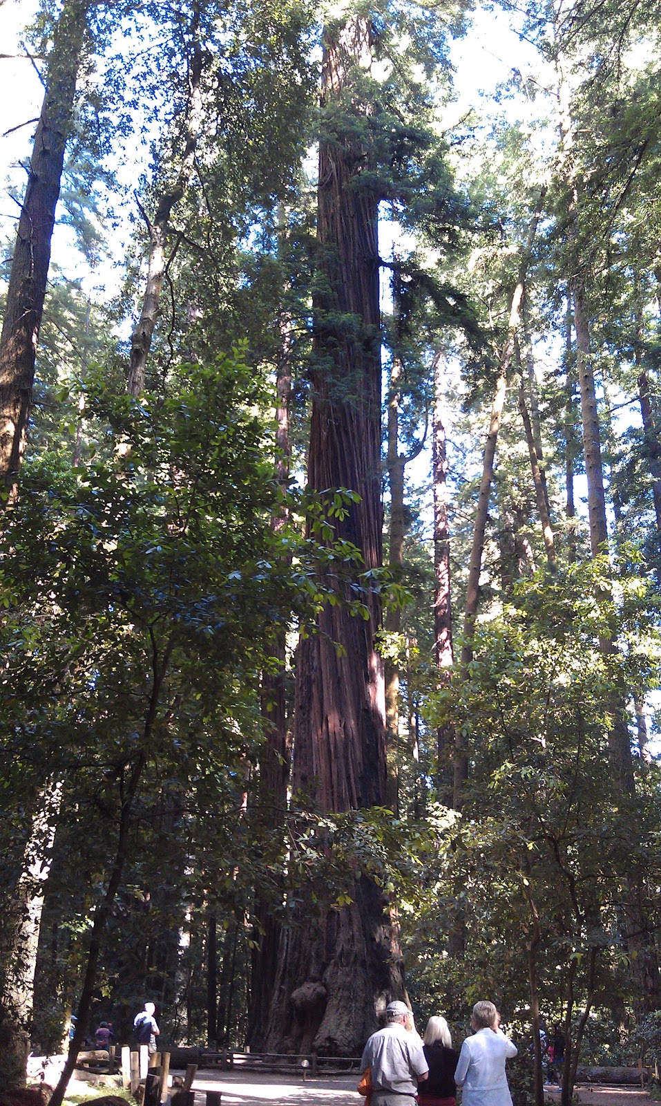
Trail Markers!
Be warned that trail markers (three stacked rocks along the edges of trails) are a bit more flexible in location and information. For example, as we hiked in more of a southeasterly direction following trail signs we joked that perhaps we were following a Bart Simpson trail, and perhaps we were right. Who's to say who marks the trail? We assumed that good natured hikers were marking our way, however we discovered that some good natured hikers were lost too. After an hour, and approximately a mile loop that managed to head directly over the tallest mountain on the ridge, we found the buried pipeline that was also mentioned on the trail description. Following this makeshift road back west, we ran back into the main trail and rejoined just in time to find the bridge that crosses the river.  The river marks the approximate mile mark.
Just past the creek you'll find a railroad track. Small history lesson here: This still active track was build by Chinese labor back in the day and continues to be used to transport cargo and passengers. From our experience the cargo train passes through around 12:30 on Saturdays. I highly recommend taking a pause either by the creek or tracks as the next 1.25 miles gains approximately 800 feet of elevation via boulders and gravel. This part is a doozy. With a steady pace, and a few much needed breaks, we reached the top in just over an hour.

Just over the top brings you to the first of the three lakes. (we actually found five lakes not counting the third of the Loch Leven, but perhaps I'm just splitting hairs) As the trail description states the first lake is nice but quite popular and consequently rather busy. Sparse campfire pits are located throughout the area as are a few nice shady spots for a lunch break, just be sure to pull out the bug spray. Even at 2:30 in the afternoon the mosquitoes were out in force.  We stopped here for a nice lunch of hummus and red peppers and let the pup get her feet wet in the lake. As you traverse the west side of the lake you'll come across a fork in the trail. Straight ahead leads to the second and third lake, while a right turn will take you to Salmon lakes that is, ironically, not a popular fishing lake. There is said to be another trail head and hike that leads into Salmon lake offering wildflowers and more seclusion that I will perhaps attempt on another weekend.

Continuing on to the second lake brings you out of the shade and onto a granite outcropping with a great view of the valley and a much cleaner, more swimmer friendly lake. The camping here is tricky as there isn't much protection from the elements. The trail heads around the lake, counter-clockwise and back up the east side. The trail returns to creative signage, incorporating orange spray paint, and becomes more tricky to navigate. To get to the third lake, which is rumored to be the best, head up the east bank, between it and a another smaller lake (unnamed) until you find the trail the veers east and up to the final lake.

Due in part to our added cargo, late start, getting "lost" and the heat we stopped at the second lake. Here we lost the trail and heard tale that the final lake was "over two ridges and full of mosquitoes." That was about all we needed to hear. We dropped our bags and made camp. Come to find out it was not a moment too soon. It seemed the pup had a bit too much of the hot gravel and upon inspection I found numerous blisters and sores on her worn out pads. This was the first realization of the trip that this little girl was a trooper. As soon as we stopped, she dropped where she stood and refused to move an inch. Mind that she, up to this point, had not whimpered or even limped for the entirety of the hike in.


The camping was mostly uneventful, and I'll spare you much of the boring details. Highlights include the realization that one can have too many instant mashed potatoes, over packing leads to sore backs, I have a new love for the Jetboil system, pack plenty of bug spray when camping near lakes, not to mention sunscreen, and after a long hike nothing quite hits the spot like a little protein and sugar. We were ready for bed long before the sun set, but we sat inside the tent and watched the clouds as the circling rescue helicopter lulled us to sleep. *Remember that when camping and cooking in the California National Forest you need to obtain a campfire permit. You can get them in person or online for free. This one worked for us, but be sure to check and make sure it will work for you too.* 


Pup licked her sore feet through the night and I worried about her ability to hike out the next day, seriously considering the possibility of having to carry her out. I had originally planned to hike to Salmon Lake on the way out and investigate the alternate trail, but with pup limping like she was walking on hot coals, I decided that a direct hike out would be best. I was also glad I brought along her hiking boots. about 15 minutes of rather awkward walking pup was back to normal, almost, and we started our hike out. I also opted to carry her pack for her as well to give her muscles a little more of a break. Thirty minutes down the trail a squirrel crossed our path and as pup took off with the thud of her boots hitting the soil in pursuit I figured she was doing alright. (Once again so glad I packed her boots.)
Pup, with her hiking boots, enjoying a
rest in the wildflowers.

While the trail in took four and a half hours (with our detour), the hike out took just over two, including a long break in the shade by the railroad tracks. This trail is much more challenging than the our previous hikes starting at an approximate elevation of 6000 feet and climbing to approximately 6800 feet but water is plentiful for refills as long as you pack a filtration or sanitizing system. In all it was a great hike to break in the backpack and other gear and a great reminder to pack light!
Looks like someone forgot the pack light!


Pros: Beautiful lakes, interesting hike, cooler temperatures due to altitude.

Cons: Long drive (an hour and thirty past Auburn), steep terrain, and heavy use.

Rating: 4/5 for difficulty, 4/5 for pleasantness.


Saturday, June 9, 2012

University Falls - Georgetown, Ca.

June 9, 2012 - University Falls (aka Pilot Creek Falls) - Georgetown, Ca.

This weekend hike took us to Georgetown, Ca. and while our hike changed last minute, due to forgetting the trail guide at home, I believe it was a change for the better. As any good hiker knows, before setting out onto a new trail, checking in at the local ranger station is a smart thing to do. In this circumstance, the ranger had a fantastic alternate trail for us. When it gets hot it seems the locals head to a well know trail that leads to a graduated waterfall about 2.5 miles in.

Once in Gerogetown, about an hour east from Auburn on highway 49, head east on Main Street approximately 3 miles to the ranger station. They have maps and other helpful items, even a gift store. Take a right out of the parking and drive approximately 8 more miles. just past Sand Mountain Blvd. (on the right) is a yellow gate blocking a fire road. If memory serves correctly it is across the road from a fire station. Parking is limited and I was told that the police patrol for poorly parked vehicles blocking the road. We parked in a lovely shady spot on Sand Mountain Blvd. and walked the block to the yellow gate that serves as the trail head.

The first half of the trail is a wide fire road, with rather creative markings. At the first fork, about 100 feet in, stay to the right. At the next fork, with the painted blue tree in the middle, stay to the left. When you see the downed log with the blue arrows, bear right and off the fire road. The next fork is marked by painted stones and trees and leads you to more of a trail and the start of the rather steep decent. Sturdy hiking shoes are recommended simply for the traction as it can get slippery.
 The bottom of the hills leads you to the reward. A mild creek leads to four waterfalls that double as water slides. Along the hike are signs that inform the visitors of the high traffic and reminds hikers that they are on private property for much of the hike and to respect the area by packing out trash. It also informs hikers that while the waterfalls are beautiful and double as water slides, the fourth waterfall has had hazardous effects on those that attempt it.

The trail is quite well traveled and the waterfalls are rather busy on the weekends. On this particular day we shared the view and the slides with 50 or so other hikers of all ages. The trail in all takes about an hour and a half each way, however due to the slides, plan to spend the day.

 The Pros: Easy hike, great waterfalls, fun slides.

The Cons: High traffic, long drive.

The Rating: 2/5 for difficulty, 4/5 for overall pleasantness

Saturday, June 2, 2012

The Placer Big Trees Grove - Tahoe National Forest - Foresthill, Ca

June 2, 2012 - The Placer Big Trees Grove - Tahoe National Forest - Foresthill, Ca

Week two brings us to a hike through old growth forest and the promise of wildflowers. From Auburn, take the Foresthill exit to Foresthill Road, and cross one of my favorite bridges, also the tallest bridge in California. This road is windy, but the locals know it well and drive accordingly, be sure to use the turn-outs as needed. About 15 miles in, on the right hand side, is the U.S. Forest Service Foresthill Ranger Station. Stop here to pick up trail maps and an interpretive pamphlet for the hike. This is an interpretive hike, with a lot of history, the pamphlet will help answer questions, help you identify local vegetation, and offer some rather interesting history about these ancient trees. Just over a mile past the Ranger Station turn right onto Mosquito Ridge Road. About 25 miles of beautiful winding road later is the turn marked for the Placer Big Trees. Be sure to take your time on this road. It is beautiful, and offers great views of the canyon, but takes quite a bit of time. From the Foresthill exit to the trail head takes about 60 - 80 minutes.Follow the signs to the large parking area. There is a bathroom and picnic area.
This hike offers two trails that intersect. The trail head directs you to the main loop and interpretive trail: The Big Trees Loop. This trail has markers and leads you through the history of the the grove, introduces you to some of the Giant Sequoias and a rather large Douglas Fir, and identifies multiple evergreen trees and wildflowers. Due to a rather odd and cold spring the Wild Iris were just finishing their bloom as appeared to be the Dogwood, and the Azalea had not yet begun to flower. There are 17 markers on the the trail that correspond to the pamphlet. This loop will drop you back off at the trail head and takes about 40 minutes.

The second trail, the Forest View Trail, starts to the right of the trail head, or at marker 13. This trail is a bit more strenuous, taking you up, or down, a rather steep hill near marker 13 and is not as clearly marked, however it is not difficult to follow. This trail takes about 40 minutes as well, and is about a mile long. If you have time, I recommend both trails. To complete this trail we did the Big Trees Loop backwards from 17 to 13 and then turned right to climb the hill, of course since it is a loop, there really is no right or wrong way. My hiking companion for the day decided she wanted to be a hiking anti-conformist.

Both trails are well shaded and peaceful, as well as quite free of people. It also meanders by a creek, which in addition to adding tranquility, increases the mosquito count so repellent is recommended, as are close toed, sturdy shoes, especially for the Forest View Trail.

The Pros: shady, peaceful, educational, moderately easy hike, bathrooms and picnic area.

The Cons: long drive, some mosquitoes.

The Rating: 1/5 for difficulty (2/5 for the Forest View Trail), 4/5 for overall pleasantness (due in part to the educational factor).