Wednesday, August 1, 2012

Tasman Lookout - Piha, New Zealand


September 1, 2012 - Tasman Lookout Track - Piha, New Zealand

From Auckland head west. That's about all I really know. I'd been to New Zealand, specifically Auckland before, and yet somehow I'd never made it to Auckland's west coast beaches. Surf beaches they are called, and crazy I was called for wanting to visit them in the winter. However, the good luck I had been enjoying so far held out. The weather stayed within the city limits and the sun broke through the clouds and even warmed me out of my multiple layers.

The road into Piha is a bit tricky, windy and beautiful. My recommendation: find a local so you can kick back, enjoy the ride and take pictures. (Not to mention they drive on the wrong side of the road which makes for a few intense left hand turns.) As you descend into Piha take a minute and borrow the steep driveway off the left hand shoulder for a great picture opportunity. Don't worry if you miss it, you'll be able to stop again on the way out.

Once you enter the actual town of Piha head toward the left side of the beach. In the center of the beach, that large land-form you see is known as Lion Rock. It splits the beach into two sections. The left section is the one you'll be hiking on. Don't be distracted by the amazing beach houses, or the beautiful beach, and easy access... you'll have time to check it out soon. I promise. Instead head toward the parking lot and make your way to back. You'll see a trail head that leads you up the cliff via a old wooded, potentially moist steps. Dogs must be on leash through here as there are birds about, including penguins that nest  in the hills.

Beware the wild Kiwi.
Similar to a hobbit,
but these climb trees. 
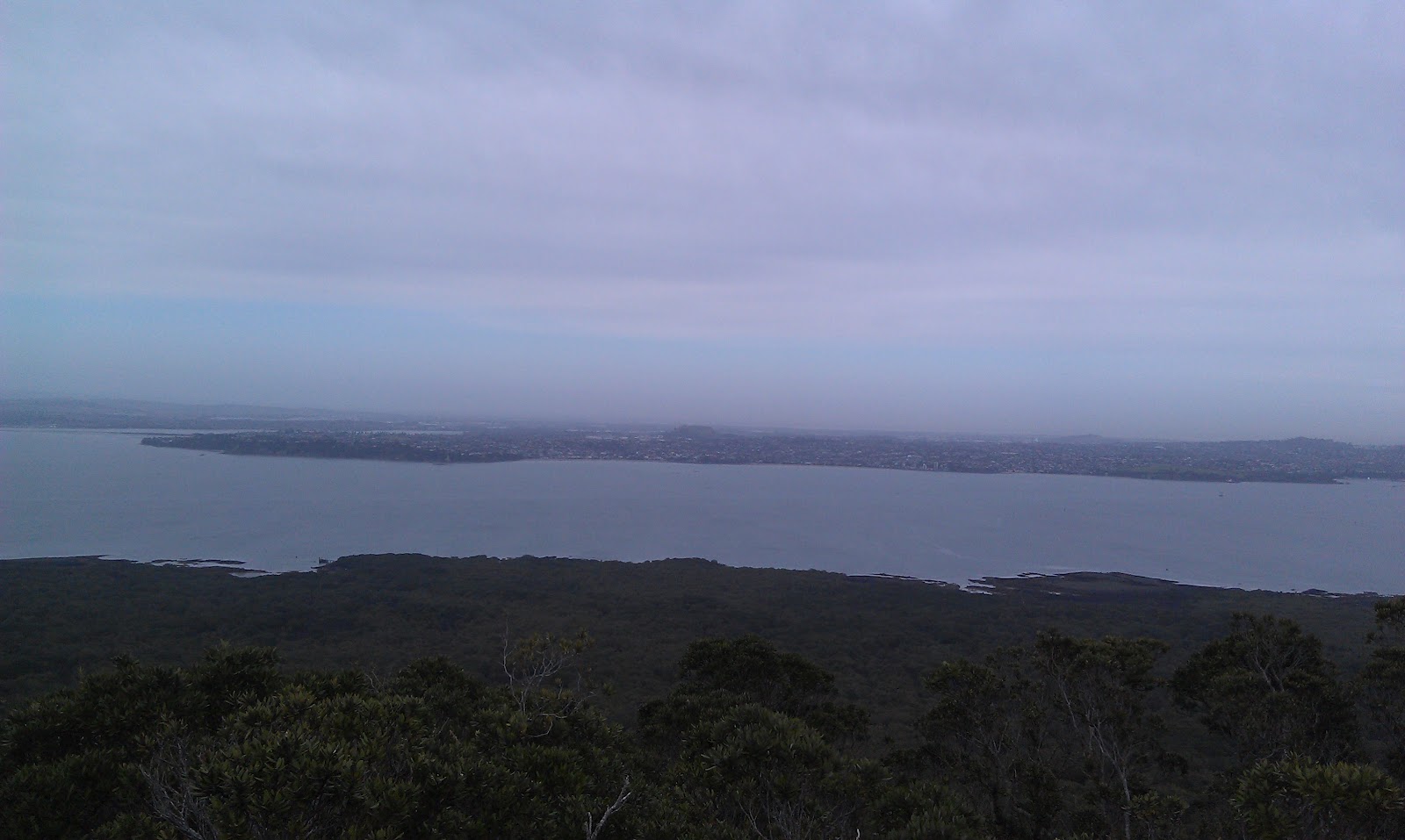
Up the trail you'll come to many offshoots. The first lakes you to a really nice lookout. After this one I recommend sticking to the trail. This can get tricky as the trail is overgrown in places... just keep an eye out for the "steps." The trail I believe is meant to be an in and back sort. However when the tide is out, the actual "trail" will give you access to a secluded beach that is separated from the main beach by rocks and ocean. The offshoot trails are tempting but end in cliffs and slippery, less forgiving accesses to the secluded beach.

As I said if the tide is out you can return to the main beach by following the coastline back, and climbing over a few rocks. (I recommend following the trail in this clockwise direction as the trail is much harder to locate from the beach.)Before you venture home on the 20 minute trail I recommend investigating the rhythmic pounding off to your left. You'll notice a rather blunt rock shelf and multiple openings in the rock cliff. As the waves crash upon the shelf the result is a large spray of water initially, than as is drains off, the water makes it's way into the openings and eventually out in a maze-like, delayed fashion. Quite the photo opportunity.

The cliff face straight ahead of the trail, blocking the ocean views, offers an interesting hike, but I recommend it with caution as the wind blows more fiercely, it is wet, and as my hiking partner discovered, more of the openings exist and let water out onto your pants and hiking boots if you aren't careful. It also poses a potential danger as it is a cliff with sandy, wet sections, and an unforgiving culmination in the instance of a fall.

Making your way back in a clockwise fashion you'll notice a hole in the rock wall which allows for tides to come through and offer a unique picture opportunity. And as you continue back toward the main beach you'll find the rocky section I mentioned earlier. Another tourist did manage this hike in heels of some sort, however I would recommend a sturdy shoe, as there are ample slippery rocks, and the New Zealand Green Lip Mussel. Painful yet pretty.

If time abounds you can continue along the main beach to Lion Rock and either make the climb up or continue beyond to the right side of the beach. On this particular day the beach's river was a bit high so we opted for the meat pie shop just down the road and made friends with some rather confident birds and once surprisingly scary duck.

Pros: Beautiful beach and flora. Decent pie shop.
Cons: (beyond the travel time) Hike is dependent on tides.
Rating: 3/5 for difficulty due to tides and slippery surfaces. 4/5  for overall pleasantness (it is winter at the beach after all), and the trail would be amazing if it were a bit longer.


Tuesday, July 31, 2012

Rangitoto, Auckland, New Zealand

July 31, 2012 - Rangitoto Island, Auckland, New Zealand

Once again, barring the plane trip, customs and other navigation hazards, once you find yourself on the other side of the Pacific in the Hauraki Gulf you'll find yourself a short ferry ride from the base of a volcano that overlooks the city of Auckland.

Look for the Ferry Building at the end of Queen's Street in Auckland and pay the $27 NZ dollars for a round trip to Rangitoto. (Side note you can find discounts in the various tourist guides around town which could save you a few bucks.)

The ferry takes about a half an hour with a quick stop on Davenport. Be sure to take the early ferry as there are only a few returning ferries, and they have no problem leaving you on the island all night if you miss it. I happened to go on a weekday in the winter, so not only were there only two returning ferries for the entire day, but I was one of three hikers at the dock. The first ferry on a weekday leaves Auckland at 9:15, giving you a decent amount of time to hike and catch the 12:45 return ferry, and ample time to catch the 3:30pm ferry (the last one of the day).

Another note, there are no facilities on the island. There is rumor of a bathroom, however bring any snacks and water with you. You can buy some things on the ferry, but you'll pay dearly for them.

Once you are dropped off on the dock head toward the building. You'll see some rather interesting signs discussing the various flora and fauna as well as some history. The island has rather unique plant life due to the volcanic rock and heat. It used to be a vacation spot and there are some old rustic cabins (bach houses) along the shore that you can visit as well, just keep an eye on the time.

You'll also find a Volcanic Explorer Tour that starts at the dock and travels up the volcano via a paved road and a tractor. It costs about $60 for an adult and half that for a child. Of course if a tractor trip is your speed you are reading the wrong blog.

Continue past the "amenities" to your right and look for the trail marker pointing towards the "Main Track." This trail is a steady climb to the top on volcanic rock gravel so bring sturdy shoes. While a lighter shoe will do, the rocks are rough and do retain a significant amount of heat.

Once past the fist half mile or so you will leave the exposed gravel path and enter the more lush portion of the hike. Birds, ferns and Pohutukawa abound. The shade is welcome at this point. I started the hike in jeans, and multiple layers to combat the cold wintry weather and ended up in a tank top shortly into the hike.

As you hike you'll see a few offshoots to other trails such as the Kidney Fern Walk, Wilson's Park Track, and the Lava Caves. I skipped the first, and headed for the third. (Don't worry we'll come back to the Wilson Track later.) Just over thirty minutes will bring you to a shaded open area with a random shed off to the right. In front of you will be wooded steps and the trail to the summit. We'll come back to this, however first head to the right, behind the shed and off to find the lava caves. I hope you brought a "torch" (flashlight) or have one on your cell phone.

The Lava Cave trail is a loop. You'll come to the first one on your left. It's not easy to miss, it's the big hole in the ground. If you are brave enough (remember there are no snakes in New Zealand and nothing that will kill you) then head into the first cave and out the other side. You'll have to do some minor bouldering on the way out so make sure you are fit enough to climb over a few rocks. Even though I could see the exit I still found myself getting a bit nervous and jumpy.

Once out the other side continue down the rocky path to the second cave. This one is a bit more ominous, and significantly longer. If you look closely you'll see light at the "end" of this one too, however the "end" is actually the middle, and the actual end is out of sight. Of course by this time you'll have already come halfway and be inclined to finish it having not died yet. Do it. It's worth it.

Unfortunately this is the end of the trail and you'll need to turn back. I imagine there are more caves in the area, but being a solo hiker, and keeping an eye on my watch, I deemed it in my best interest to keep to the trail and hustle back to find the summit. Head back to the shed and this time continue straight up the wooden steps once again on the "Main Track." Not far past this juncture you'll come across the more wooden steps leading both left and right. This is the accessible path used by those tractor folks. The actual trail continues on and loops around to the summit. Either trail will work, and in consideration of time I took the wooden steps up and to the left.

On a clear day the summit offers views of Auckland, and other various beaches and islands in and around the gulf. You can even see the dock where you started this trip and get an idea of just how far you've traveled.

The map supplied by the ferry building has multiple hikes and roads that traverse the island. They even include estimated times. I wanted to explore more of the island, but again was watching my clock. The trip up, including the cave detour took about an hour and a half, which gave me about an hour and half to get back to the ferry building. I considered multiple options then decided on a slightly alternate route back (I dislike backtracking). If you don't have the time head back the way you came, and simple enough, you'll be back at the dock in about an hour. If, like me you like a little adventure, not to mention some of the most interesting trail to date, then keep reading.

For the return trip head down the wooden steps to the "Summit Road." After looking both ways for tractors ;) head to the left, down hill. a quarter mile or less of the riveting road will bring you to a trail sign pointing to "Wilson's Park Tract." The trail head is a little more difficult to find but once you are on it, it is simple enough to follow. This trail winds in around, up and down back toward the crater and the Main Track. Take your time here as it is slippery, narrow and rather breath taking. The map indicates this trail takes about 20 minutes which is accurate if not a little shy. I'd plan for 25-30 minutes until it spits you back out on the Main Track. At this point head back down the hill and, if there is still time, you can attempt the Kidney Fern Walk, or visit the houses up and down the Coastal Road.

This hike, dock to dock took about 2.5 hours, not including the Kindey Fern Walk, and I was back on the ferry with a few minutes to spare. There are many more hikes, including a Coastal Track that heads east to Islington Bay Wharf and some historic homes, that I was unable to try on this venture, but would like to do the next time I find myself on this particular volcano.

Pros: Scenic, simple, interesting lava caves, great coastal weather, and birds.
Cons: Don't miss the last ferry.
Rating: 2/5 for difficulty, 5/5 for pleasantness

Friday, July 27, 2012

Rangiputa, Far North, New Zealand

July 27, 2012- Rangiputa, Far North, New Zealand

For this lovely beach hike I'll spare you the directions, its gets a little tricky somewhere over the Pacific, however if you do find yourself in the Far North of New Zealand I highly recommend finding your way to the beach; isn't hard the country is surrounded by them, literally.

This particular hike comes complimentary with the stay at the vacation house "bach" in Rangiputa, one coastal village in the oh so certain, Doubtless Bay, thank you Captain Cook for your astute observation, and to the locals for keeping such an apt name.

Once you find your way to Rangiputa, just north of the Bay of Islands (also a great place to visit) and South of Cape Reinga (also a nice day trip), follow the main road the mile or so to it's conclusion at Puwheke Marginal Strip. It's a small stretch of beach maintained by the Department of Conservation (DOC), I imagine much like our state parks in the states.

Park just beyond the sign, or if you are staying at the Bach, simply open the sliding door, step carefully down the steps, across the lawn and road and down another small set of stairs.

The beach here is quite flat, and the tide goes out quite far. During low tide there are a few exposed rocks and plenty of interesting shells to find. I recommend taking a left from the sign and heading southeast along the beach toward the orange buoys. This will take you past a number of baches (beach vacation homes) and a small beach front hotel. On your right over the water is a small stretch of land that protrudes into the bay making the water quite sheltered and calm.


Speaking of water, even on a wintery day the water is clear and calm, and comparable in temperature to the nicest of days on the other side of the Pacific. It is rather hard to believe but this beach is in fact the same water found off the west coast of the States. If the weather is nice I'd recommend a stroll through the water. It is so clear and flat on this beach that a stroll is exactly what you'd be doing.

This hike is rather unlimited, confined only by the time you have available. From the "trail head" a tall orange marker is visible approximately a mile down shore. This is the point that I chose to hike to, and back. With frequent stops for pictures and the occasional shell this hike round trip took just over an hour in total. Just beyond the marker is a rather unique inlet that is part beach, and part marsh. Definitely worth a quick look.

On the way back the beach extends beyond the "trail head" and around the corner to a very private and sheltered beach with a few tide pools at low tide. Be sure to include this into your adventure, as it is a great way to conclude the hike.

On this day, thanks to the switch in hemispheres, I enjoyed wintery weather: breezy and highs in the mid teens (Celsius). But still a clear and beautiful day. I am told that in the summer it is much nicer, I imagine high 20's, but it is also more crowded. I was able to enjoy this hike in complete isolation from any other hikers, tourists and locals alike, however considering the population of this tiny village I cant imagine that even on the most crowded of days that it would be unpleasant.

Of course, the empty beach may have been in part due to my timing. Jet lag and a slight affinity for dawn on the beach, had me up and hiking in the twilight, watching the sunrise over the eastern hills and turning the western sky a lovely shade of pink. I highly recommend a sunrise beach hike at least once in your life, even if you cant manage it on this visit.

Pros: breathtaking views, calm water, pristine white sand beaches, wonderful people (if you can find any).

Cons: a bit of a long way to travel (had to be mentioned), slightly cold in the winter.

Overall Rating: 1/5 for difficulty, 5/5 for overall pleasantness (would have been a 6 if i didn't have to wear the extent of my winter wardrobe).

Kia Ora mate!

Sunday, July 15, 2012

Hendy Woods State Park, Philo, CA

July 15, 2012 - Hendy Woods State Park, Philo, CA

One more time I find myself hiking in a redwood grove. This I've however I've rough the four legged pup, and according to the rules of the park system, we're resigned to the fire road.

But I'm getting ahead of myself. First we have to get to the trailhead.

For this hike we had to head to the coastal range north of the San Francisco bay. From the Sacramento valley head east on interstate 80 towards Vallejo. Take the exit for highway 37 to highway 101. Once on 101 head north towards Ukiah. Head east on high way 128. The road here is quite windy, so take your time, watch your speed, and take your Dramamine.

You'll find your way to Boonville and head about 10 miles beyond. Side note there are many wineries in the area, as well as a lovely redwood campsite just past Boonville, if you choose to make a weekend out of it.

Follow the signs to Hendy Woods State Park on Philo Greenwood Road. Don't forget your state parks pass, or bring your admission fees. (12 dollars in 2012. Parking and trails are at the very back of the road.

Once you've found parking take note of the creek running up the north east side of the park, you and the pup may want to visit this after the hike.

While many trails start at the parking lot, the dog friendly fire road is pack up the road a quarter mile or so on the right.

Now, even though it is listed as a fire road it is not the typical valley version with wide sun-beaten, dry dusty expanses. This fire road is simply a wider gravel trail with ample shade and decent views of the woods and aforementioned creek.

The trail winds mostly uphill, at a leisurely pace, and there are a few offshoots that lead back into the other trails, and one even heads uphill to the entrance of a working farm.

On this day we chose to head in for a specified time and back out the way we came. The trail had no end in sight and the park map shows it at leading off the edge and on into eternity.

Overall the trail is unimpressive at best, however after a weekend of wine tasting, it's a great, dog friendly way to sneak in a nice hike while making a weekend out a trip to this beautiful area.

Pros: dog friendly, shaded, lovely weekend area
Cons: limited access at park, only one trail, fire road, very long drive from Placer County - needs to be a weekend trip.
Rating: 2/5 for difficulty (minor incline), 2/5 for overall pleasantness.

Wednesday, July 11, 2012

Big Basin - Santa Cruz County, CA


July 11, 2012 - Big Basin Redwoods State Park - Santa Cruz County, Ca

I seem to be on a Redwood State Park kick, and this hike fit in perfectly. While the drive, yet again, was long, it was well worth the trip. The park itself has multiple options for hikers. Hikes range from the half mile Redwood Loop Trail, to the potential overnight/backpacking Skyline to Sea Trail which takes you out of the state park, into the West Waddell Creek Wilderness, and all the way to the ocean. The downside of all of these wonderful trail is that they are not dog friendly. Super sad face.

No matter, today we opted for the Creeping Forest Trail, one because it had a cool name, and two because it promised ample shade to counteract the surprisingly warm day. It also promised to be approximately 4 miles.

On your way into Santa Cruz (on hwy 17) head west on Highway 9, and further west on Highway 236. It's a windy stretch of road so take you time and drive carefully. Once inside the park you'll find rather nice bathrooms, water, ranger station, and a gift shop. Locate the main parking area and adjacent Redwood Loop Trail. All the trails start inside the loop, less than 100 feet from the entrance if you complete the loop in a counter clockwise direction. We opted for the extra half mile by taking the trail clockwise. The loop trail boasts some very tall Coastal Redwoods and the standard interpretive numbered plaques.  


Once you find the trail heads (follow signs for the Skyline to Sea trail) you'll cross a bridge and hit a  T intersection. Even though these trails are not overly accessible for anyone needing walking assistance, the signs, for some reason, are all posted with mileage for the accessible portions. In other words, ignore the mileage, and really you can get a little creative with the trail signs too as they are a bit... interpretive. You'll be intersecting the Skyline to Sea Trail in the middle, and unfortunately the signs tell you nothing of this, or for that matter, of the trail you are looking for. Regardless, head right on the Skyline trail (away from the ocean) and keep an eye out for similar trail signs that will help you eventually find the Creeping Forest Trail. 


This trail starts by following the creek north and past the Dool Trail (you'll be ending up here later so feel free to throw out a few of those bread crumbs). Just past the Dool trail marker you'll come across a picnic area and small road. Cross the road (yup this is the right trail) and keep an eye out for the left turn and trail marker for the Creeping Forest Trail. If you miss turn you'll be in for a rather long hike to Saratoga. 


This is where the trail starts to climb and maintains a steady up and down trek for the next mile and a half. Part of this trail parallels that road you crossed earlier, but there are no more intersections to worry about. As you hike you'll pass multiple small groves of redwoods. It's a peaceful hike, and we didn't pass a single hiker on our way.

Eventually the trail turns back in an overall southern direction. You'll find another trail marker just past a rather extensive section of trail that winds along side the road, a increasingly frustrating tease keeping the hiker guessing when, just when the trail will finally merge and cross. However, eventually it does cross and you'll come across the trail marker for the Dool Trail. This is where the  Creeping Forest Trail ends. Head to the left on the Dool trail and it will spit you back out on the Skyline to Sea Trail (this time head south). A few paces down the Dool you'll find a lovely memorial bench that invites you to sit and enjoy the enchantment. While we were enticed and attempted the partake, the view left a bit to be desired and the mosquitoes took the the opportunity to have dinner.

In all it was a lovely hike that we wrapped up in a visit to the beach and the boardwalk for a free movie and a few souvenirs. Beware the summer temps drop significantly when the sun goes down, and sweatshirts are expensive!

Pros: lovely trail and trees, low traffic, close to the beach, plenty of alternate trails.
Cons: Long drive, hot, parallels a road for a significant portion.
Rating: 3/5 for difficulty and 4/5 for overall pleasantness.

Saturday, July 7, 2012

Robinson's Flat - Tahoe National Forest, Ca

 July 7, 2012 - Robinson's Flat - Tahoe National Forest, Ca

Beware, this is quite possibly my favorite hike, my favorite on this blog for sure.

Head east from Auburn toward Foresthill on Foresthill Road. I recommend stopping in at the Ranger's Station, about 15 miles in, on the right. They have trail maps for this hike, among others. Continue past the Ranger's Station for 27 miles, well beyond town, and down the one lane road. Luckily you can't miss the trailhead/campsite as the road T's at the entrance.

This is a campsite and trail area. Horses are permitted as are mountain bikes. There is a bathroom, but no trash cans.

The campsite is adjacent to an old ranger station with out-buildings and a nice meadow that used to house ranger/fire fighters 70+ years ago. If you are interested in the history, there are informational signs and the buildings are staged to look as they did when they were in use.

There are two trails here: the Meadow loop trail, which I assume lops the meadow in a 1/4 mile or less, and the Bald Mountain trail which takes the hiker up to a nice overlook and through a peaceful lightly wooded forest. The elevation is 6800 feet, plus a few hundred for the overlook, so there is no poison oak, and unlike our last hike the ticks were not out, or at least not hungry.

This is a loop trail, and I recommend completing it in a counterclockwise direction for ease of trail navigation. From the bathroom head farther into the campground and look for the trail markers (and fence) on the south side of the campsites. There is a trail head marker at the ranger station, but we found that it took us to the left of the trail head and we had to climb over the aforementioned fence, but that was easy enough.

The trail is well marked and while it is an incline, it is relatively easy. Total elevation gain is about 800 feet. the trail crosses a sturdy bridge and makes it way up the mountain. At the top I am told there is a .5 mile trail to the overlook. I missed this on our trek, but I am told it is well worth a look. The trail makes it way to the right and back down, 4 miles in all. (4.5 if you have to backtrack to find a lost dog bootie.) Even with the summer heat, the trail is well shaded for most of it, keeping temperatures down. It is rather dusty in sections and more barren at the top of the mountain however so sunscreen or a hat is recommended.

On this particular Saturday I was not busy in the slightest, and the view was spectacular, combined with the wildflowers, tree canopy, length and overall lovely day, this is easily my favorite hike.

Pros: Scenic, good length, wildflowers in summer, good views, low traffic, bathrooms.
Cons: a little dusty in sections, long drive.
Rating: 2.5/5 for difficulty, 4.5/5 for overall pleasantness

Saturday, June 30, 2012

Olmstead Loop, Aurburn State Recreation Area, Cool, Ca

June 30, 2012 - Olmstead Loop - Knickerbocker Canyon - Auburn State Recreation Area - Cool, Ca

Oh boy, where do I start with this one? 

First, this trail is known for wildflowers and great views of the canyon, in the spring. My not-so-trusty guidebook suggested this hike for May, however the author's suggested hikes for June had me heading over an hour south I decided to check this trail out in June. The absolute last day of June to be exact. Not my best idea.

Head east from Auburn on 49, follow the highway across the bridge towards cool. (Notice the beautiful and refreshing river here, you'll be missing it later.) Just before the only stop sign in Cool, yes that one, and the fire station, take a right. It's ok, highway is a lofty term for this isolated stretch of road so a u-turn shouldn't be a problem. (It'll be a left turn now.)
It started out nice...

There is a parking lot behind the fire station and a self-pay day use fee. If you choose to park here, the lower lot is for cars, upper lot for horses. I, forgetting my CA state parks pass, opted to park in a nearby parking lot and walk in, via the handy access path. There is water here, hoses and horse troughs, which came in handy at the culmination of the hike.

My guidebook suggested doing the trail in reverse (counter clock-wise) which came in handy for counting down how many miles we had left, and for our shortcut. However I think both ways have their bonuses, for example the end of our hike was rather barren and quite warm, something that may have been better at the start.

The first big view
Moving on. The counter clockwise trail starts on the north side of the parking lot across the road. It parallels 49 and makes it's way around a fenced field, which is a common theme. About a half mile up the road there is a fork and the Olmstead trail turns right with a dirt road extending straight ahead. If you opt for the dirt road version it is supposed to cut off a mile or so from the hike. We opted for the shortcut.

There are many trails that intersect with the loop. The trail is decently marked with yellow triangles reminding the user of trail etiquette.  These are useful if you are worried about getting off track, however since it is a loop, just keep veering to the left when in doubt, or follow the most used trail and you'll be fine. The loop without shortcuts is 8-9 miles with 2 significant up-hill sections and one significant creek crossing. Do be aware that coyotes do frequent the area, as do snakes. Luckily we saw none of the former and the latter one was not poisonous. Phew.

"Tick Creek"
The views are fantastic and the creeks are refreshing, however the large sunny fire road leaves much to be desired, especially in June. As well the wildflowers are long gone.The other downside of this trail, besides popularity and frequent horse related presents, was not discovered until the first creek and then more thoroughly once we returned. Ticks. My guidebook did warn about off-trail consequences such as ticks, so I kept my four-legged friend on leash and out of the brush. Her entire off-leash activities consisted of a 5 minute swim in the creek. I also thought that the heat of the day and time of year would help to diminish the risks. 40+, that's how many ticks we pulled off my little friend, or found in and around the house over the next 3 days. two of which decided to crawl on me in search of their next meal. Yuck, made sleeping very difficult as I was sure there were more in my room and bed, and my skin cooperated by inventing new itches throughout those sleepless nights.
We made it! From here you can see where
we took the first view picture. Waaaay over there... 

In the end the unanimous decision was that this trail is not worth the effort. Heat, ticks, dry, barren, and heavy traffic outweighed the views and the easy access.


Pros: easy to find, ample parking, wide trails
Cons: too hot and dry in the summer, heavy use, TICKS!
Rating: 3/5 for difficulty (due to length and few hills), 1/5 for pleasantness.